News

Moving from beta to live

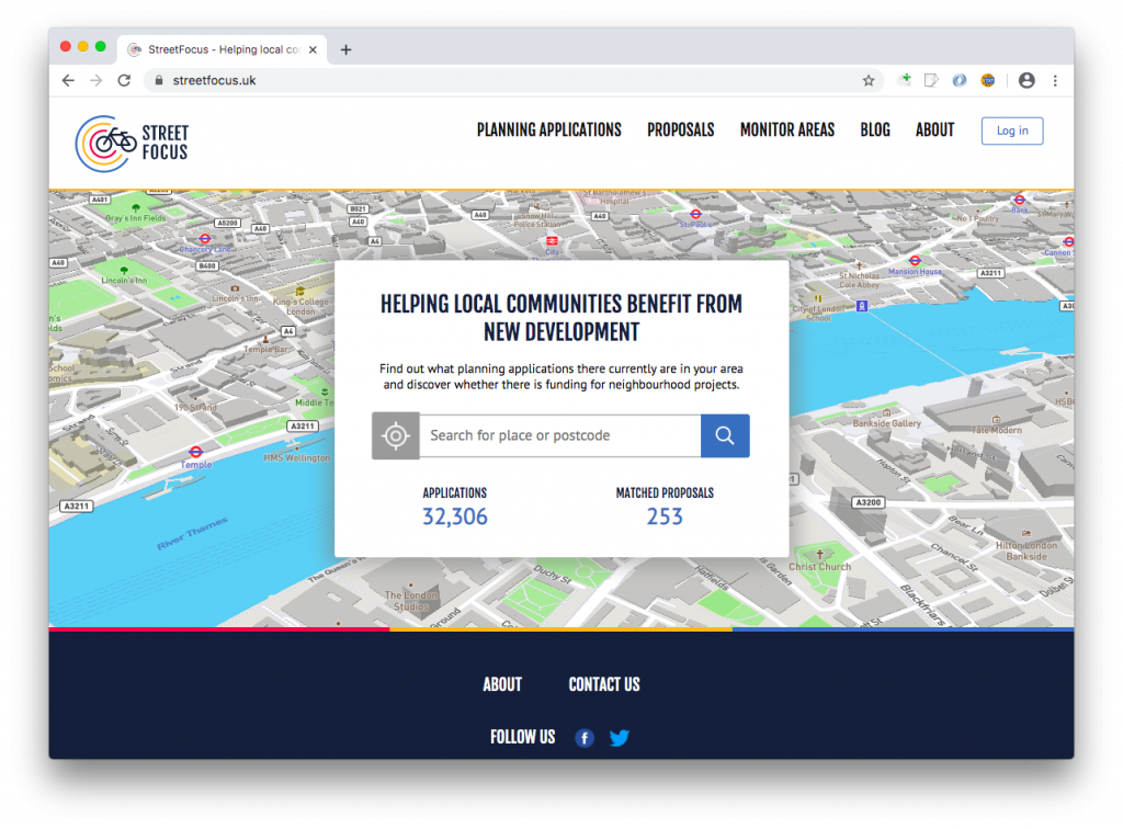
Following the launch of our beta site in March, just before lockdown hit us and disrupted many of our plans, we’re now busily working much more actively on StreetFocus again!

We’re working towards a launch in April, with some tidying-up likely in May/June in response to user feedback.

The key areas of work remaining are:

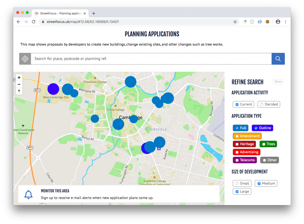
  • Critically, to make the planning applications map fast. Currently the planning applications map works but can take 20 seconds to appear, which is unacceptably slow. This is because no work has yet been done to optimise the massive database from which this database appears, by setting up a more specific replicated database dedicated to StreetFocus. This is a significant piece of work, and typical of the kind needed when moving from a beta project (where the principles have been successfully demonstrated) to a public release (where everything must be polished and fast).
  • Enabling of the ‘planning alerts’ feature. Currently the user interface to enable people to subscribe to planning alerts about their area is in place, but it is not activated. There is remaining work to be done to deal fully with the subscription logic.
  • Add support for integrating third party ‘ideas’ data sources, e.g. ideas maps from Local Authority systems (subject to licensing conditions, as unfortunately many such systems are not yet openly-licensed data). These would then appear on the ideas map, which tries to match ideas with planning applications.
  • Ability for local groups, to add their own projects directly to the ideas map. For instance, residents’ associations and campaign groups have their own databases of ideas. Currently the beta site ideas map pulls data only from our own website Cyclescape, by way of a proof of concept, but we want to expand this. This has been requested during our beta feedback.

Let us know if you have ideas that we can incorporate!

We hope shortly to announce some new funding towards the site, for which we are grateful, subject to confirmation.

StreetFocus beta now live!

Since last summer, we’ve been working hard to create the new StreetFocus website. We’re pleased to say that it’s now available, at www.streetfocus.uk.

The site is a ‘beta’ – ready to use, but may have some bugs!

With the site, we concentrated on two key aims, which arose from our research with decision-makers, organisations, officials, and local people:

  • View planning applications – proposed new buildings and other changes – in your area and beyond.
  • Matching ideas for community changes (crowdsourced from the public) with those planning applications that could fund them.

The site:

  • Has a clear map of all planning applications nationally, updated daily.
  • Enables you to filter by size of planning application, type, and status.
  • Gives a clear summary for each application, and provides simple buttons to take you to the Council’s consultation page.
  • Aims to pick out key documents automatically (currently limited to Design & Access Statement).
  • Matches up large applications with potential S106 proposals, in the form of issues from a transport-based website, Cyclescape.
  • [Available shortly] Enables you to monitor area(s) including setting filters. E.g. you might want to set a monitor for all of Cambridge with medium/large only, and a monitor for everything on your street for personal interest. (The user interface for this is done but it’s not yet sending out e-mails.)
  • Is desktop and mobile -friendly!

Work to create the new site has been funded by Innovate UK, as well as a grant from South Cambridgeshire District Council. We’ve also been working with Leeds University, who are using the data in a new project looking at transport access to new developments.

Data for the site comes from our project partner, PlanIt – who have worked hard to make the data more reliable, to make it filterable, and to make the map display fast!

As the site is now available for people to try, we’re at the stage of seeking feedback. We’ll be contacting Local Authorities, community groups, and interest groups around the UK to get their thoughts on how the site will work for them, and what they’d like us to work on next.

Let us know your thoughts!

Introducing StreetFocus

StreetFocus is a new project being created by CycleStreets, a social enterprise in Cambridge, and which is funded by the Geospatial Commission / Innovate UK. [Press release.] Martin, one of the developers of CycleStreets, who are running the project, talks about how we can use planning application data to bring benefits to local communities.

Throughout the UK, public street infrastructure does not yet always meet the standards of the best European cities. Changes have been piecemeal, rather than based on a vision of beautiful and practical places to be enjoyed. At the same time, people sometimes lack transport choices, so taking the opportunity to allocate space to public transport, walking and cycling, when streets are redesigned means that levels of traffic can be reduced and people can live healthier lives.

These benefits can often be delivered when new developments are being planned. Communities are keen to have more influence in decision-making to ensure this. But sadly, new developments sometimes cause disputes, rather than being seen as opportunities to fulfil long-desired improvements to an area.

StreetFocus aims to enable Local Authorities and communities to achieve improvements to their streets by automatically identifying where desired improvements could be funded by developers, to mutual benefit.

Time and time again, such opportunities for street improvements are lost because local government is sometimes rather disconnected. Moreover, there is no way for local communities to register future desires in a systematic way. A planning officer considering a proposed new commercial estate is unlikely to be aware that transport groups have been pushing for a safe cycleway on the adjacent road for instance. Likewise, a Highway Authority may be unaware of ideas for a new route from an existing estate to the nearby park, which would increase physical activity and reduce crime.

StreetFocus will work by combining information from PlanIt, a national aggregator of local authority planning application data, with Cyclescape, a site to enabling local people to crowdsource long-desired changes to street infrastructure.

PlanIt has, for the first time, created a national, open database of planning applications, enabling people to see proposed changes near them easily on a map. CycleStreets and PlanIt are working together as partners on the project.

Our lead developer at CycleStreets, explains:

“Around the UK, there are so many opportunities to improve local streets to make them more attractive places to live and which give people transport choice. We were excited when the Geospatial Commission announced funding for innovative projects like StreetFocus. By matching the desires of local people for changes to their streets with the new developments that could fund them, happier and healthier places to live, travel, work and shop can be created. The planning system is ripe for innovation, and there is much potential for the government’s open data agenda to be applied to it.”

We will be working to create StreetFocus over the coming nine months, and will be talking to Local Authorities, community groups, and decision-makers around the country to research how particular elements of the planning system could be improved, to the benefit of all.